Excel charts
with Dynamic Arrays 055:
US election map
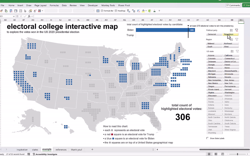
What you see above is just a humble replica from an interesting visualization of the US elections of 2020 by French newspaper Le Monde. And this visualization is shown below:
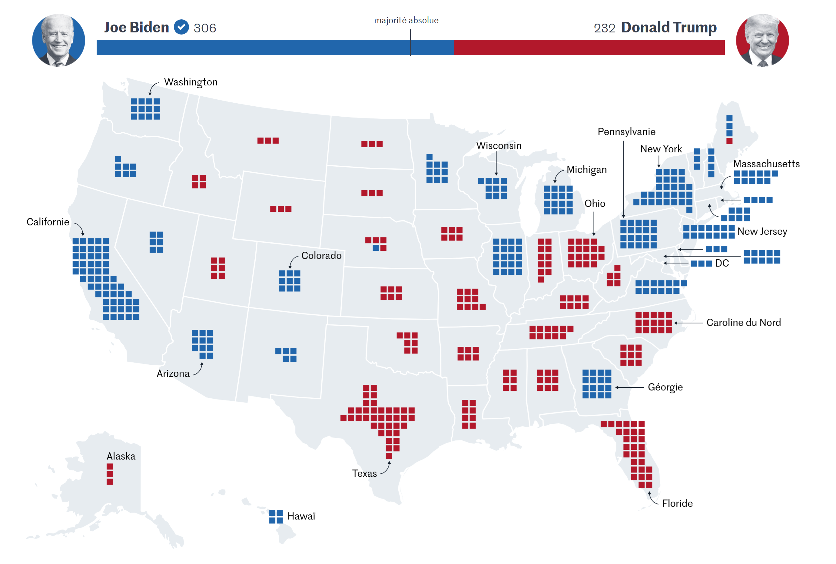 source: https://www.lemonde.fr/international/article/2020/11/04/elections-americaines-2020-suivez-la-carte-des-resultats-en-direct_6058394_3210.html
When it comes to the presidential elections in United States, a common geographical visualization type that gets trendy in news outlets are; the bipartisan colored choropleths or also known as filled maps. But there is a caveat to watch out for with regards to choropleths and elections.
For comments, questions or feedback, please feel free to leave them on comments section of the video above on YouTube. And, if you would like to get a copy of the file, you can download it from the button below.
And don’t forget: life is short.